
There are many federal programs that are or can be related to building flood resilience and recovery. Below is not an all-inclusive list but a list of the programs that, at this time, we have identified as most relevant to our policy platform.
Federal Emergency Management Agency (FEMA)
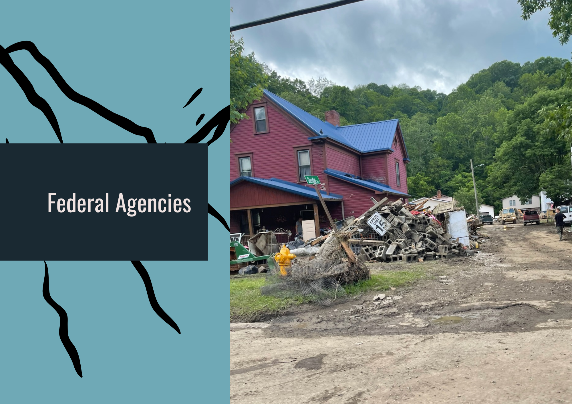
Building Resilient Infrastructure and Communities Program (BRIC): These were competitive grants that supported hazard mitigation projects led by states, communities, tribes, and territories. In April 2025, the Trump Administration directed FEMA to end BRIC in its entirety.
Disaster Case Management (DCM): These are awards to a state, tribal, or territorial government or non-governmental organization to assist disaster-impacted individuals and families through the recovery process.
Flood Mitigation Assistance (FMA): This is a competitive grant program that supports projects to reduce or eliminate the risk of repetitive flood damage to buildings that are insured by the National Flood Insurance Program (NFIP).
Hazard Mitigation Grant Program (HMGP): These are grants to states and local, tribal, and territorial governments to help develop and implement hazard mitigation plans, available after a presidentially-declared disaster.
Individual Assistance (IA): Grants to eligible individuals and households who have sustained losses as a direct result of a disaster that receives a Presidential disaster declaration. These funds can help to pay for temporary housing, medical or funeral expenses, property losses, and more.
Individuals and Households Program (IHP): This is a type of Individual Assistance, which provides financial support and direct services to eligible individuals and households affected by a disaster to help meet immediate, basic needs.
National Flood Insurance Program (NFIP): NFIP provides flood insurance to property owners, renters, and businesses. The program is administered by FEMA, and insurance policies are sold and serviced via a network of insurance companies.
Public Assistance (PA): These grants reimburse state, county, and local governments for costs associated with debris removal, emergency protective measures, and public infrastructure repairs after a disaster.
Housing & Urban Development (HUD)
Community Development Block Grant - Disaster Recovery (CDBG-DR): These grants to states, counties, local governments, tribes, and territories help to rebuild disaster-impacted areas and assist with long-term recovery. However, these funds must be appropriated by Congress following a presidentially-declared disaster.
National Oceanic and Atmospheric Administration (NOAA)
Atlas 15: NOAA’s Atlas 15 is the definitive National Precipitation Frequency Atlas, at the moment under development with the NOAA National Weather Service (NWS) Office of Water Prediction (OWP). Atlas 15 will provide estimates of expected precipitation depth and intensity for a specified storm duration at a particular location.
Office of Surface Mining, Reclamation, & Enforcement (OSMRE)
Appalachian Regional Reforestation Initiative (ARRI): This is a federal initiative supported by local and state governments, non-profits, universities, coal operators, and more. Since 2004, ARRI has helped to reclaim hundreds of thousands of former and active mine sites using the science-based Forestry Reclamation Approach (FRA).
U.S. Army Corps of Engineers (USACE)
Planning Assistance to States (PAS): PAS provides states, local governments, non-profits, and eligible Tribes assistance in preparing comprehensive plans for the development and conservation of water and related land resources. PAS covers planning only, and does not provide any details on potential project construction.
U.S. Department of Agriculture (USDA)
Emergency Watershed Protection Program (EWP): EWP provides financial and technical assistance to local governments, Tribes, and tribal organizations to help communities relieve imminent threats to life and property caused by natural disasters that impair a watershed. EWP funding does not require a Presidential (or state) disaster declaration.
U.S. Geological Survey (USGS)
Federal Priority Streamgages (FPS) Network: This network of nearly 3,400 streamgages tracks, in near real-time, streamflows across the U.S. Designed to be a stable backbone network, the FPS provides crucial, timely information that saves lives, saves property, and informs the work of numerous federal agencies, including Department of Homeland Security, FEMA and the National Oceanic and Atmospheric Administration, along with numerous state and local governments.
National Streamflow Network: This network of about 8,700 streamgages complements the FPS; National Streamflow Network gages are funded via up to a 50 percent cost-share between USGS and Tribal, regional, state, or local partners. The National Streamflow Network is a key source for tracking and analyzing potential flood events.