
Platform Overview
The Flood Resilience in Appalachia: Policy Recommendations (2024) was created in collaboration with dozens of regional and national organizations. The research and policy recommendations presented are intended to cover the intersections of the region’s unique challenges for natural disasters:
Limited state and local staffing capacity to proactive mitigate risks and effectively recover from floods
The comingled relationship between systemic poverty and flooding
A lack of sufficient mapping data for rural, mountainous communities
The impact of an extractive economy on the region’s hydrology
Each of these unique challenges are covered in a pillar with corresponding federal policy recommendations. We believe that, in order for Appalachia to become flood resilient, it must tackle each of these problems simultaneously.
We encourage you to use this platform as a guide to learn more about our region’s unique flood risks and what Congress and federal agencies can do to help.

Local governments are intended to be the first responders when disasters strike, however, many small towns in Appalachia do not have the funding or staff to adequately respond to flooding.
Access to federal funds for disaster response and recovery requires local resources — both human and financial — and these are in short supply as local budgets in coal communities have been in steady and dramatic decline.
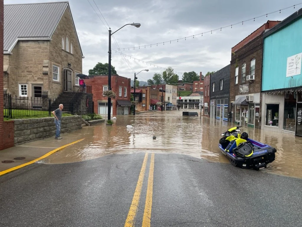
The cost to low-income communities during disaster recovery efforts are straining household budgets.
In Appalachia, the annual median household income is $48,964, more than $20,000 less than the national median of $70,622. The average poverty rate is 16.3 percent, compared to a national average of 14.6 percent.
While homeownership rates in Appalachian states are relatively high compared to the national average, rural Appalachian individuals are more likely to have poor credit scores, face increased cost of credit, have higher rates of denial for mortgage applications, and have higher debt burden than the national average.
Inability to recover after a natural disaster may lead to displacement, further exacerbating issues of population decline in Appalachian communities.
Federal investments in flood mapping have not kept pace with the need or with increasing climate impacts; thousands of U.S. communities lack maps, and about 15 percent of community flood maps are over 15 years old.
More expansive and accurate maps – that account for climate change, and incorporate community views – are needed, particularly in rural Appalachian communities, as historically mapping efforts have targeted higher population areas.

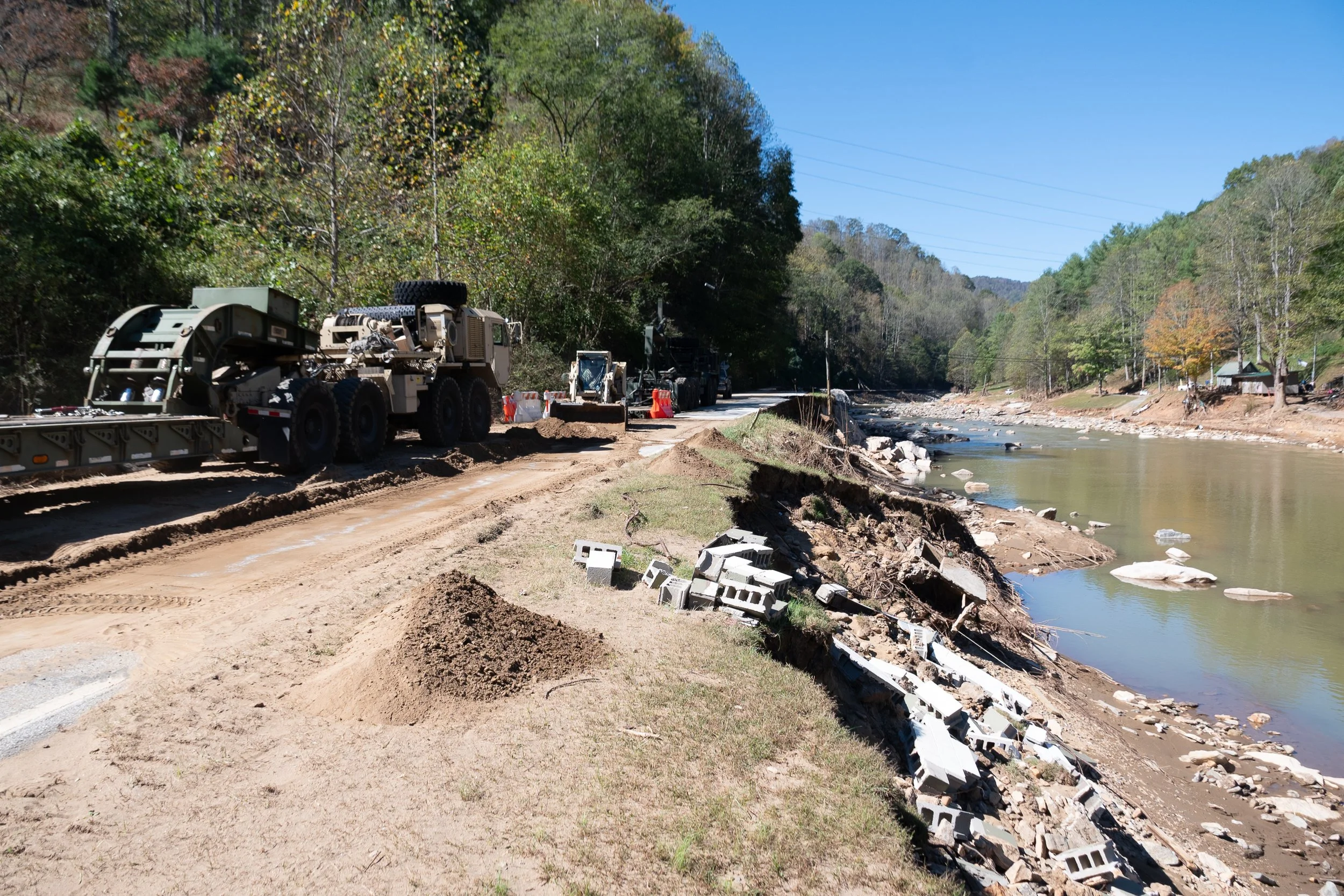
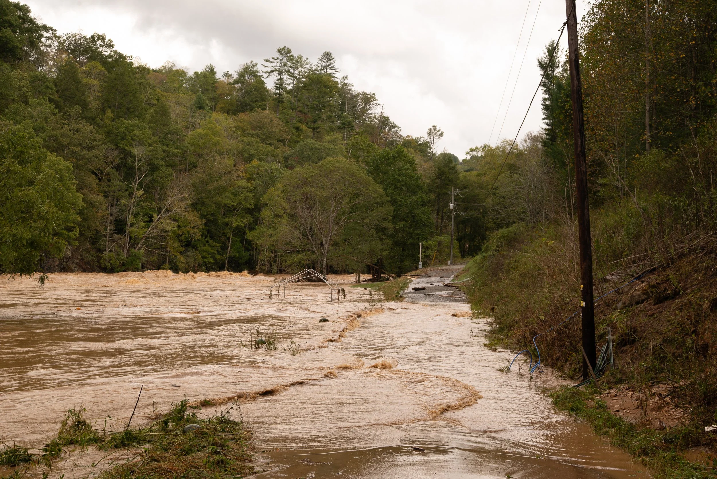
Appalachia's landscape, and its history of extraction, have made its communities uniquely vulnerable to climate-induced flooding. Human activity on the landscape – especially from coal mining, logging, and road and home construction – has impacted the region in disparate ways.
The land’s topography, with its rolling hills and mountains, means people often live adjacent to rivers or streams, where limited flat land is located. Logging and mining have reduced the land’s capacity to retain rainfall, especially where land has not been properly restored.
Restoring and protecting the landscape, including via investments in nature-based solutions, are needed to better protect Appalachian communities, and to build long-term climate resilience.